 IrħulaCompare places →
Home / Malta / Marsaxlokk
Malta · South Eastern
Living in Marsaxlokk
Harbour mornings. A village rhythm.
Explore Marsaxlokk & compare →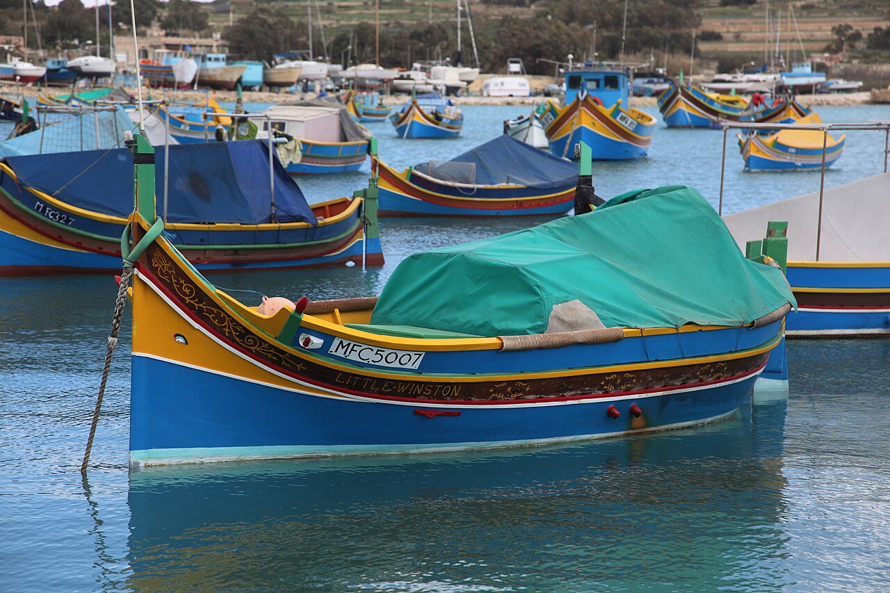
Source snapshot: 2 November 2026. Each measure keeps its own date and geography.
About Marsaxlokk
A fishing harbour known for colourful boats and its waterfront. It offers a different coastal setting from Malta’s larger urban seafronts.
Marsaxlokk is a useful choice when you want the day to revolve around a waterfront walk and a meal. Transport Malta’s sightseeing information identifies stops in the village, including Xatt is-Sajjieda and the San Luċjan Tower area. That helps place the destination within a south-coast outing, but a route map should not become an instruction to cover every listed stop. The harbour is best enjoyed with time to pause. Keep your plans centred on the village if the aim is a slower day.
Reasons to explore
- Harbour character and waterfront walks
- A distinctive village setting
Things to consider
- Waterfront activity can change the feel of a street
- Test the journey to your regular destinations
Monthly rent
1 bedroom
Sample too small to publishper month
2 bedrooms
€1,300per month · 71 listings
3 bedrooms
€1,500per month · 95 listings
Median asking rents for mixed residential long lets, 2 November 2026. Advertised rents are not signed contract prices. Small samples are withheld.
Sources: Darna Price Index · rent by bedrooms
Cost of living, excluding rent
€781 per month for one person; €2,898 for a family of four. This is a national crowdsourced reference dated 1 November 2026, applied unchanged across places. Add rent separately.
Sources: Numbeo: Cost of Living in Malta
Property purchase prices
Median sale asking price: €428,895 (61 listings). Q3 2026, mixed property types; not a price per square metre or a completed-sale valuation.
Sources: Darscover Malta Asking Price Index
Population and geography
4,327 residents (2025). NSO administrative-locality boundary; not a count for the settlement centre alone
Local council · South Eastern
Sources: NSO usually resident population by locality · NSO district and locality classification
Safety
Residential theft rate band: Below the national rate. Total recorded offences rate band: Below the national rate.
2025 council-level CrimeMalta statistics. These are relative reported-offence rates, not a personal safety prediction. A verified town homicide count is not available in this dataset.
Sources: CrimeMalta Annual Crime Review 2025
Construction and planning
12 approved new dwellings in Q2 2026 (council geography). 8 recently validated planning applications or matching address records, 3 October–2 November 2026.
Applications and permissions do not prove works are happening on site. Check the address and PA case details before choosing a street.
- PA/07188/26 — Il-Quccata, Triq l-Gholjiet ta' Guno, Marsaxlokk (pending)
- PA/07151/26 — Agricultural Field at, Tal-Basal, Delimara, Marsaxlokk (pending)
- PA/06950/26 — 9 and 11, Sqaq Busbiesi, Marsaxlokk (pending)
- PA/06909/26 — Vacant Site, Triq l-Gholjiet ta' Guno, Marsaxlokk (pending)
- PA/06900/26 — Scorfna House, Delimara, Marsaxlokk (pending)
Sources: NSO Residential Building Permits Q2/2026 · PA public register · PropertyList index
Roadworks and noise
31 roadworks permits with dates covering 2 November 2026, based on exact Transport Malta source labels. Permit windows are not confirmation of active work.
Strategic noise contours describe modelled road and aircraft exposure using 2021 reference data. They do not measure current village noise, festa sound or building work. Explore the interactive profile for contour bands and nearby sampling.
Sources: Transport Malta eGIS · roadworks permits · EEA / Malta strategic environmental noise contours
Electricity and water
8 street reports in the 30-day Dawl community snapshot. 3 water interruption notices in the snapshot. Data captured 2 November 2026; absence of a notice does not prove uninterrupted service.
Sources: Dawl community outage map · Water Services Corporation interruptions
Air quality
Regional model PM2.5: 4.1 μg/m³; PM10: 13.9 μg/m³; European AQI: 26, valid 2026-11-02T13:00. CAMS model cells cover roughly 11 km and are shared across towns. This is a dated regional snapshot, not a street sensor or a long-term clean-air ranking.
Sources: CAMS Europe / Open-Meteo regional air model · ERA air-quality monitoring
Nearby amenities
Mapped within 1 km of the named place point. Counts can cross locality boundaries and depend on OpenStreetMap coverage.
groceries
pharmacies
healthcare
schools
outdoors
bus Stops
food